Kanton Island (Kanton)
Canton Island (also known as Kanton or Abariringa), previously known as Mary Island, Mary Balcout's Island or Swallow Island, is the largest, northernmost, and, the sole inhabited island of the Phoenix Islands, in the Republic of Kiribati. It is an atoll located in the South Pacific Ocean roughly halfway between Hawaii and Fiji. The island is a narrow ribbon of land around a lagoon; an area of 40 sqkm. Canton's closest neighbour is the uninhabited Enderbury Island, 63 km west-southwest. The capital of Kiribati, South Tarawa, lies 1,765 km to the west. , the population was 20, down from 61 in 2000. The island's sole village is called Tebaronga.
Kiribati declared the Phoenix Islands Protected Area in 2006, with the park being expanded in 2008. The 425,300 km2 marine reserve contains eight coral atolls, including Canton. Because it is inhabited, management of Canton Island is described in the Canton Resource Use Sustainability Plan (KRUSP), which covers a 12 nmi radius around the atoll. Over 50% of the island and lagoon are protected in a conservation zone.
On 5 August 1824, the whaler Phœnix of London (master John Palmer) in the company of whaler Mary of London, came to a low and barren island with a spacious lagoon, in latitude 2° 48ʹ S and longitude 172° 10ʹ W, and it was named "Mary Ballcotts Island". H.E. Maude and Niel Gunson both assumed this to be the whaler Mary, owned by John Lydekker (1778–1832), and that her captain Edward Reed Lacy had reported the island. The entry for 5 August 1824 of that Mary's logbook, however, mentions no discovery, nor a ship Phœnix. The ship Mary truly there that day (her master presumably Abijah Lock) was another whaler from London, owned by Hill, Boulcott & Hill, a firm consisting of the two brothers James & Amon Hill and their brother-in-law John Ellerker Boulcott. The latter was married to a Mary Boulcott, née Hill, and it was she for whom this island was named. Ever since it was incorrectly penned down as "Mary Ballcotts Island" in William Dalton's journal, it has appeared with deviated spelling in books and on charts as Mary-Bulrock, Mary Balcout, Marie Ballcout, etc.
Modern Canton derives its name from the New Bedford whaler Canton, which was wrecked on its outer shore in early March 1854. Captain Andrew Johnson Wing (1820–1897) and his full crew managed to save not only themselves but also four small whaleboats and scanty provisions. In late March, the 31 men tried their luck by putting to sea in the four open boats and made their way northwest for 49 days straight when finally they reached safety in Guam, 2,900 nautical miles from where they had started. Kanton is spelled with a K in the Gilbertese language, which has no letter C. The two versions of the name exist in the Constitution of 1979.
Map - Kanton Island (Kanton)
Map
Country - Kiribati
 |
 |
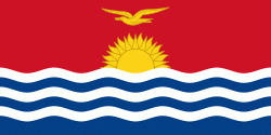
| Flag of Kiribati | |
The islands' spread straddles the equator and the 180th meridian, although the International Date Line goes around Kiribati and swings far to the east, almost reaching 150°W. This brings Kiribati's easternmost islands, the southern Line Islands south of Hawaii, into the same day as the Gilbert Islands and places them in the most advanced time zone on Earth: UTC+14.
Currency / Language
| ISO | Currency | Symbol | Significant figures |
|---|---|---|---|
| AUD | Australian dollar | $ | 2 |
| ISO | Language |
|---|---|
| EN | English language |


